How GPS and Mapping Apps Changed the Way We Navigate.
GPS technology & mapping apps have reshaped the way we navigate, transitioning from traditional paper maps to real-time, location-based guidance. These innovations have enhanced convenience, safety, efficiency for travelers, businesses, emergency services. With real-time traffic updates, voice assistance, multimodal options, they have transformed the travel experience, enabling more accurate and personalized navigation in both urban and rural environments, shaping modern-day exploration.
✨ Raghav Jain
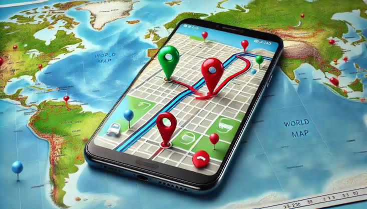
How GPS and Mapping Apps Changed the Way We Navigate
Navigation has undergone a monumental transformation over the last few decades. From the days of physical maps and compasses to the sophisticated GPS-enabled smartphones and mapping apps we use today, the way we navigate the world has evolved dramatically. Global Positioning System (GPS) and mapping apps have revolutionized not only how we find our way but also how we understand and interact with our surroundings. These technologies have become an integral part of our daily lives, simplifying travel, enhancing safety, and even reshaping industries and social behaviors.
The Rise of GPS: From Military to Mainstream
The story of GPS begins in the 1970s when the U.S. Department of Defense developed the system for military navigation. The idea was to create a satellite-based navigation system that could pinpoint the location of any object anywhere on Earth, regardless of weather conditions or time of day. Originally named NAVSTAR GPS, the system became fully operational in the 1990s, providing users with the ability to determine their exact location within a few meters.
At first, GPS technology was restricted to military and commercial aviation uses. However, in 2000, the U.S. government made GPS signals available for civilian use, removing the accuracy limitations that had been in place. This opened the door to countless commercial applications, leading to the development of GPS-based navigation devices for vehicles and smartphones.
The Advent of Mapping Apps: Making Navigation Accessible
As GPS technology became more accessible, the need for easy-to-use mapping solutions grew. In the early 2000s, digital mapping apps started to emerge. These apps combined GPS data with digital maps to help users navigate in real time. One of the first widely recognized mapping apps was Google Maps, launched in 2005. Google Maps, with its clear and detailed maps, provided turn-by-turn directions for both driving and walking, changing the way people thought about navigation.
In the years that followed, many other mapping apps emerged, including Apple Maps, Waze, and HERE Maps. These apps offered different features, such as traffic updates, rerouting capabilities, real-time user-generated data (in the case of Waze), and public transportation information. The combination of GPS and mapping technology made it easier than ever to get from one place to another, whether by car, foot, bike, or public transportation.
Features That Revolutionized Navigation
The popularity of mapping apps can be attributed to their numerous features that simplify navigation and improve the overall travel experience. Some of the most notable features include:
1. Turn-by-Turn Navigation
The introduction of turn-by-turn navigation was a game-changer for drivers and pedestrians alike. Users no longer had to stop and consult paper maps or rely on their memory of street names. Mapping apps now give users real-time, step-by-step instructions, ensuring they stay on the correct route without distractions. This has made driving easier, especially in unfamiliar or congested areas.
2. Real-Time Traffic Updates
One of the most significant advancements of modern mapping apps is the integration of real-time traffic data. Using GPS data from other users, these apps can provide live traffic updates and suggest alternative routes to avoid congestion. Waze, for example, relies heavily on crowd-sourced information to warn users about accidents, road closures, and speed traps, allowing them to make more informed decisions about their route.
3. Voice Assistance
Voice navigation has eliminated the need to glance at a screen while driving. With voice prompts, users can keep their eyes on the road while receiving guidance on when to turn or exit. This feature has greatly improved safety, especially for those driving in unfamiliar areas or on busy highways.
4. Offline Maps
In the past, GPS navigation apps required a stable internet connection to function. However, with the introduction of offline maps, users can now download maps of areas they’ll be traveling to and access them without needing cellular data or Wi-Fi. This has been a game-changer for travelers in remote locations or those with limited data plans.
5. Integration with Other Services
Modern mapping apps integrate with other apps and services, providing a more comprehensive navigation experience. For example, Google Maps and Apple Maps allow users to search for businesses, read reviews, and even make reservations. These apps now act as hubs for information, making it easy to discover new places and services while navigating.
6. Multi-modal Navigation
Mapping apps today offer navigation options for various modes of transportation. Whether you’re walking, driving, biking, or using public transportation, these apps provide customized directions based on your chosen mode of travel. This flexibility has made them indispensable tools for urban commuters and travelers in unfamiliar cities.
The Impact on Different Aspects of Life
The integration of GPS and mapping apps has not only changed how we get from one place to another but also impacted many areas of our lives. Here are some of the most notable effects:
1. Travel and Tourism
Mapping apps have made travel easier, more accessible, and more affordable. With detailed maps, real-time traffic updates, and user reviews, travelers can navigate foreign countries with ease, exploring new cities without getting lost. GPS has also made it easier to find hotels, restaurants, and tourist attractions, enabling spontaneous trips and experiences. For solo travelers and backpackers, GPS-equipped smartphones are now essential tools for staying safe and finding their way in unfamiliar areas.
2. Business and Logistics
GPS and mapping apps have had a profound impact on industries like logistics, delivery services, and transportation. For instance, ride-sharing companies like Uber and Lyft rely on GPS data to connect drivers with passengers and determine the best routes for picking up and dropping off customers. Delivery services like Amazon use GPS technology to track shipments and optimize delivery routes.
For businesses with physical storefronts, mapping apps have become an invaluable marketing tool. Listings on platforms like Google Maps allow businesses to reach new customers and provide essential information such as hours of operation, contact details, and reviews.
3. Safety and Emergency Services
GPS and mapping technology have improved safety for both individuals and emergency responders. GPS tracking enables parents to keep track of their children’s whereabouts, helping to ensure their safety. Moreover, emergency services can quickly locate callers in distress using GPS data, drastically improving response times and saving lives in critical situations.
4. Social and Behavioral Changes
GPS and mapping apps have also led to shifts in social behavior. The ability to share real-time locations with friends and family has created new ways for people to connect. Apps like Google Maps and Find My Friends allow users to track each other's locations, making it easier to meet up or keep in touch. This has also had a profound impact on our sense of direction. People no longer feel the need to memorize routes, relying instead on GPS to guide them.
The Future of GPS and Mapping Technology
Looking ahead, the evolution of GPS and mapping technology is set to continue. Advancements in artificial intelligence (AI), machine learning, and augmented reality (AR) will likely play significant roles in shaping the next generation of navigation tools. For example, AR could overlay navigational instructions onto real-world views through smartphones or smart glasses, offering an even more immersive and intuitive experience.
Additionally, as autonomous vehicles become a reality, GPS and mapping apps will become an essential part of self-driving cars’ navigation systems. These vehicles will rely on real-time data from GPS satellites, mapping apps, and sensors to navigate without human intervention.
The evolution of GPS technology and the proliferation of mapping apps have transformed the way we navigate the world, drastically altering both our daily lives and broader societal structures. GPS, which stands for Global Positioning System, was initially a military technology developed by the U.S. Department of Defense in the 1970s to help track and guide military assets. Its purpose was to provide precise location information to the military, ensuring strategic advantage in the field. At that time, its use was restricted to military personnel and applications, but as technology advanced and the benefits of GPS became more apparent, it was opened for civilian use in 2000. This development marked a monumental shift, not just for navigation, but for how people would come to understand and interact with their environment. Before the introduction of GPS, people relied on traditional methods of navigation, such as paper maps, road signs, and asking for directions, all of which could be inefficient, imprecise, and at times, frustrating. For travelers and drivers, relying on a paper map meant constantly stopping to consult it, trying to match your surroundings to the map, or worst of all, getting lost because of outdated or inaccurate data. When digital maps began to be integrated with GPS technology, a new era of navigation emerged, one that offered far greater ease and accuracy. This shift fundamentally altered travel, with people no longer needing to memorize routes or keep track of street names and turns. In the early stages, GPS devices were standalone gadgets, typically used in vehicles for driving navigation. These devices provided users with a reliable, real-time method of determining their position and offered turn-by-turn directions to help them reach their destination. However, it wasn't until GPS technology became integrated into smartphones that it reached a level of ubiquity that began to redefine everyday navigation. The advent of smartphone apps, particularly Google Maps, which was launched in 2005, and Apple Maps, which followed shortly thereafter, provided users with digital maps on a device they carried with them at all times, making the process of navigation more accessible and versatile than ever. The shift to mapping apps on smartphones opened up new possibilities. Not only could users get directions to a specific address, but these apps could also provide real-time traffic updates, estimate the fastest route, and even allow users to search for nearby businesses, restaurants, and points of interest. The ability to receive live updates about traffic conditions, road closures, and construction zones was especially groundbreaking. This dynamic aspect of mapping apps meant that users were no longer limited to static data from a paper map or outdated GPS device. Instead, they could respond to changing circumstances in real time, making navigation more efficient and reducing travel time significantly. Real-time data was also extended through the use of crowd-sourced information, as seen with apps like Waze. This feature allows users to contribute information about accidents, road hazards, or speed traps, creating a community-driven experience that benefits all users. This collaborative aspect of navigation apps has improved accuracy and contributed to safer, more informed travel. The impact of these apps was not limited to personal navigation alone. They also had a profound effect on the transportation and logistics industries. Ride-sharing companies such as Uber and Lyft, for instance, rely heavily on GPS data to match riders with drivers in real time, optimizing routes for efficiency and ensuring that drivers can reach their passengers quickly. Similarly, mapping apps have revolutionized delivery services, allowing companies like Amazon, Grubhub, and DoorDash to manage and optimize their routes, ensuring that deliveries are made on time and with greater accuracy. Beyond transportation, the rise of mapping apps has transformed how businesses interact with their customers. With the integration of location-based services, businesses can now be found more easily by potential customers through Google Maps or Apple Maps. Consumers can view a business’s location, read reviews, and get directions to their store all in a single app. This has made it easier for customers to discover new businesses and for businesses to maintain visibility in a crowded marketplace. The convenience offered by these apps has had an especially transformative effect on tourism and travel. Tourists, who previously might have struggled to navigate foreign cities with unfamiliar street names and cultural norms, can now easily find their way through major cities with nothing more than a smartphone. Whether it’s finding a restaurant with good reviews, locating a hotel, or navigating public transport systems, mapping apps have made exploration easier, safer, and more enjoyable. Travelers are no longer dependent on tour guides or local knowledge; they can simply rely on their smartphones for everything they need, making spontaneous travel more feasible and less stressful. However, this convenience also comes with some drawbacks. The overreliance on GPS and mapping apps can lead to a reduction in traditional navigational skills. Many people now struggle to read physical maps or navigate without the aid of technology, relying entirely on their smartphones for guidance. This has led some to question whether we are losing essential skills like memory and spatial awareness, which were once crucial for successful navigation. Moreover, while GPS technology is undeniably accurate, it is not foolproof. Errors in satellite data, poor signal reception in remote areas, or outdated maps can still lead to navigation mistakes. This is particularly problematic for those who place complete trust in their devices, assuming that they are always correct. Furthermore, the convenience of navigation apps has affected social behaviors, particularly in how we connect with others. In the past, meeting up with friends often required a set location and specific instructions on how to get there. Now, apps like Google Maps and Apple’s “Find My” feature allow individuals to share their real-time location, making it easier to meet up without needing to give or receive directions. While this adds convenience, it also raises privacy concerns, as individuals are now capable of tracking each other’s whereabouts at any time. Despite these challenges, the benefits of GPS and mapping apps have far outweighed the drawbacks. The ability to navigate effectively, safely, and efficiently has become a cornerstone of modern life, especially in busy urban environments. These technologies continue to evolve, integrating new features like offline maps, pedestrian routes, bike lanes, and even augmented reality (AR) integration. Looking to the future, it’s likely that advancements in AI and machine learning will further enhance the capabilities of GPS and mapping apps, allowing for even more personalized and intelligent navigation. Autonomous vehicles, which are already in development, will rely heavily on mapping and GPS technology to navigate without human intervention, signaling the next frontier in navigation. With each technological leap, GPS and mapping apps continue to shape not only how we navigate physical spaces but also how we perceive and experience the world around us. What once required physical maps, landmarks, and a keen sense of direction is now handled effortlessly with the tap of a finger, and as the technology continues to evolve, it will undoubtedly continue to redefine the way we understand and move through the world.
The integration of GPS technology and mapping apps has radically transformed how people navigate their surroundings, fundamentally altering not just the mechanics of travel but also the way we conceptualize movement through space, interaction with technology, and engagement with the world around us. Prior to the advent of GPS and digital maps, navigation was largely dependent on traditional methods such as paper maps, road signs, and asking for directions, which, while effective, were often time-consuming, inaccurate, or inconvenient. A journey could easily be delayed by detours, unclear instructions, or simply getting lost. The introduction of GPS, or Global Positioning System, revolutionized this process by providing real-time, satellite-based location tracking that could pinpoint one's position to within a few meters anywhere on Earth. Initially developed by the U.S. Department of Defense in the 1970s for military purposes, GPS became a public resource in 2000, leading to its widespread use in consumer technology. From the early days of car-mounted GPS devices to the smartphones that now feature highly sophisticated navigation apps, this technology has gradually become indispensable. Mapping apps such as Google Maps, Apple Maps, Waze, and others leveraged GPS data to create comprehensive digital maps, giving users the ability to navigate with ease and precision. One of the earliest benefits of these apps was the implementation of turn-by-turn directions, which provided step-by-step guidance for travelers, eliminating the need to constantly check paper maps or stop to ask for directions. This ease of navigation, however, was only the beginning. As the technology developed, mapping apps incorporated real-time data such as traffic conditions, road closures, accidents, and construction zones, significantly improving the reliability and efficiency of the routes they suggested. This real-time data has been particularly beneficial for urban travelers, enabling them to avoid congested areas, save time, and reduce fuel consumption. Additionally, the integration of crowd-sourced data, as seen with apps like Waze, has made navigation even more dynamic, as users contribute to an ongoing flow of information that others can use to adjust their routes accordingly. The ability to adjust routes in real-time has helped to make travel more predictable, as drivers can anticipate delays and avoid unnecessary detours. This shift toward highly personalized, context-aware navigation has affected not only individuals but also industries such as transportation, logistics, and delivery services. For example, ride-sharing companies like Uber and Lyft rely heavily on GPS and mapping apps to efficiently match drivers with passengers and ensure that they reach their destinations quickly and safely. In the same vein, food delivery services like DoorDash and Grubhub use GPS data to optimize routes for drivers, helping them deliver orders faster and more accurately. The impact of GPS and mapping apps extends beyond just efficiency; it has also had profound effects on safety. With the use of GPS tracking, emergency services can respond more quickly to distress calls, pinpointing the exact location of those in need of help, which is especially critical in urban areas or when people are in unfamiliar locations. Furthermore, mapping apps have introduced features such as location sharing, which allows individuals to let others know their whereabouts in real-time. This has not only improved personal safety but has also altered the dynamics of social interactions. People no longer need to rely on meeting points or vague instructions; instead, they can simply share their location and easily find one another in crowded spaces or unfamiliar locations. Additionally, these apps often provide information about nearby businesses, restaurants, and points of interest, making it easier for people to explore new areas and make informed decisions about where to go next. As a result, GPS and mapping apps have not only transformed the way we navigate but have also contributed to the emergence of new behaviors and expectations in our day-to-day lives. For instance, navigation apps have become essential tools for tourists and travelers, enabling them to explore new cities without the fear of getting lost or disoriented. What was once a daunting task—trying to read a paper map while navigating an unfamiliar place—has now been replaced with the simplicity of following digital instructions on a smartphone screen. The integration of local business information into these apps has made it easier for tourists to discover restaurants, attractions, and hotels that fit their preferences, further enhancing the travel experience. In addition to tourism, GPS and mapping apps have transformed how businesses engage with customers. Through digital maps, companies can now place themselves on the map, ensuring that potential customers can easily find their location and access relevant details such as hours of operation, reviews, and directions. For example, Google Maps allows businesses to claim their listings and manage their visibility, which in turn has driven more foot traffic to local stores and services. Furthermore, the convenience of GPS-enabled navigation has led to a shift in consumer behavior, as people have become less reliant on traditional ways of finding their way. Many people now feel uncomfortable traveling without the assistance of GPS, and some even struggle with basic navigation skills, relying entirely on their smartphones to guide them. This reliance on GPS, however, has sparked debates about the loss of navigational skills, with some arguing that we may be losing our ability to read traditional maps, estimate distances, or navigate using landmarks. While these concerns are valid, it is undeniable that GPS and mapping apps have significantly improved the accuracy, accessibility, and convenience of navigation for people worldwide. As these technologies continue to evolve, with innovations such as augmented reality and autonomous vehicles on the horizon, the future of navigation seems poised to become even more seamless and integrated into our daily lives. Augmented reality (AR) could enhance navigation apps by overlaying directional arrows or points of interest directly onto the user’s view of the real world, making navigation even more intuitive and interactive. Similarly, autonomous vehicles will rely heavily on GPS and mapping data to navigate the roads without human intervention, ensuring that cars can travel safely and efficiently on their own. GPS and mapping apps have already changed the way we navigate, and with the continued advancement of technology, they will likely continue to shape the future of how we explore and interact with the world around us. Whether through better traffic management, safer driving experiences, or more efficient public transportation systems, GPS and mapping apps will continue to be an essential tool in modern society, making travel smarter, faster, and more convenient than ever before.
Conclusion
GPS and mapping apps have fundamentally reshaped how we navigate, providing users with unprecedented levels of convenience and accuracy. These technologies have not only improved the efficiency of travel and transportation but also made it safer, more accessible, and enjoyable. As GPS and mapping technology continue to evolve, it is clear that the future of navigation will be even more integrated with artificial intelligence, autonomous vehicles, and augmented reality, creating an even more seamless and intuitive experience for users.
Q&A Section
Q1: How did GPS technology evolve from military to civilian use?
Ans: GPS technology was originally developed by the U.S. Department of Defense for military purposes in the 1970s. However, in 2000, the U.S. government made GPS signals available for civilian use, removing accuracy limitations and allowing the technology to be used in consumer devices such as vehicles and smartphones.
Q2: What are the key features that make mapping apps useful?
Ans: Mapping apps offer several key features, including turn-by-turn navigation, real-time traffic updates, voice assistance, offline maps, integration with other services like businesses and reviews, and multi-modal navigation options for different transportation methods. These features make it easier for users to navigate efficiently and safely.
Q3: How has GPS technology impacted businesses?
Ans: GPS technology has significantly impacted businesses by improving logistics, delivery services, and marketing. Ride-sharing services like Uber and Lyft depend on GPS for routing, while delivery companies use GPS to track shipments. GPS also allows businesses to be listed on mapping apps, making it easier for customers to find them.
Q4: How do GPS and mapping apps enhance safety?
Ans: GPS and mapping apps enhance safety by allowing emergency services to quickly locate individuals in distress. Additionally, parents can track their children's locations, and users can share their real-time whereabouts with friends and family to ensure their safety while traveling.
Q5: What role will augmented reality (AR) play in the future of GPS and mapping apps?
Ans: Augmented reality (AR) is expected to enhance GPS and mapping apps by overlaying navigation instructions onto real-world views, providing users with more immersive and intuitive guidance. This could be particularly useful in urban environments or for pedestrians navigating complex areas.
Similar Articles
Find more relatable content in similar Articles
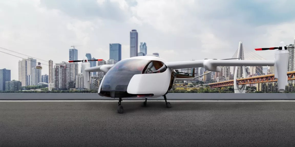
The Future of Electric Planes ..
The aviation industry is under.. Read More

E-Waste Crisis: The Race to Bu..
The rapid growth of electronic.. Read More
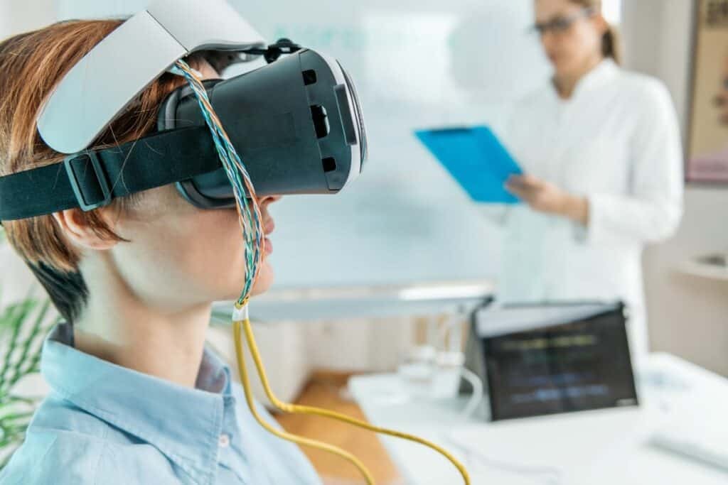
Virtual Reality Therapy: Heali..
Virtual Reality Therapy (VRT) .. Read More

3D-Printed Organs: Are We Clos..
3D-printed organs are at the f.. Read More
Explore Other Categories
Explore many different categories of articles ranging from Gadgets to Security
Smart Devices, Gear & Innovations
Discover in-depth reviews, hands-on experiences, and expert insights on the newest gadgets—from smartphones to smartwatches, headphones, wearables, and everything in between. Stay ahead with the latest in tech gear
Apps That Power Your World
Explore essential mobile and desktop applications across all platforms. From productivity boosters to creative tools, we cover updates, recommendations, and how-tos to make your digital life easier and more efficient.
Tomorrow's Technology, Today's Insights
Dive into the world of emerging technologies, AI breakthroughs, space tech, robotics, and innovations shaping the future. Stay informed on what's next in the evolution of science and technology.
Protecting You in a Digital Age
Learn how to secure your data, protect your privacy, and understand the latest in online threats. We break down complex cybersecurity topics into practical advice for everyday users and professionals alike.
© 2025 Copyrights by rTechnology. All Rights Reserved.