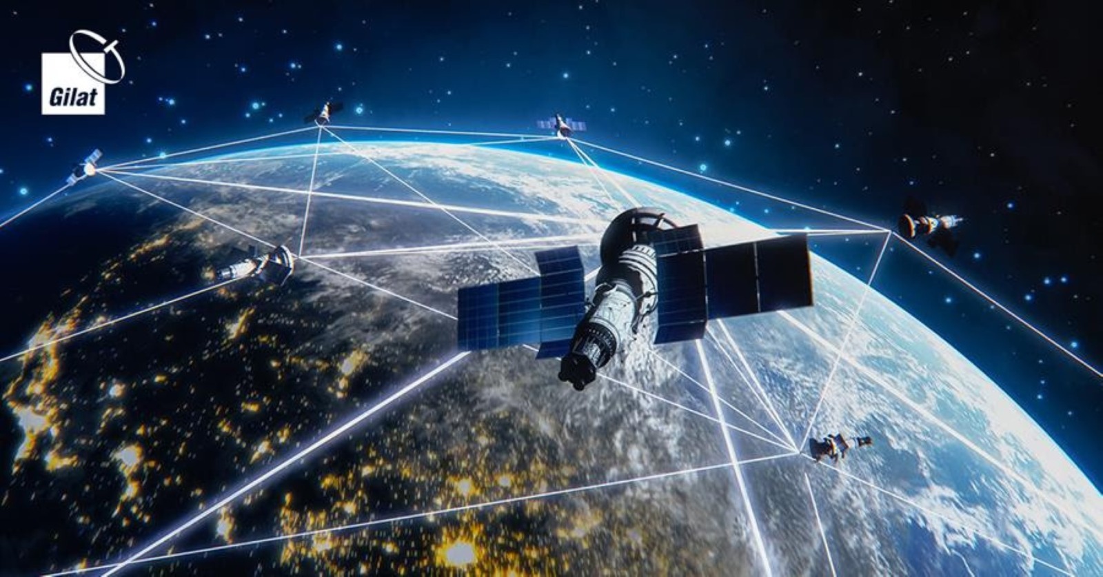
Space tech for Earth problems: using satellite data (weather, ecology, disaster response) in innovative ways.
Leveraging the power of satellite technology, scientists and policymakers are transforming how we monitor and manage Earth’s environment, predict extreme weather, respond to natural disasters, and conserve ecosystems. By integrating advanced sensors, AI analytics, and global observation networks, space-based data provides innovative solutions to complex planetary challenges, enabling smarter decision-making, sustainable resource management, and a more resilient, climate-conscious future.
✨ Raghav Jain
Introduction: When Space Helps the Earth
For decades, space exploration has fascinated humanity as a symbol of adventure, discovery, and progress. Yet, beyond the romanticism of rockets and distant planets, space technology has an equally vital mission here on Earth — solving real-world problems. From predicting hurricanes to monitoring deforestation, satellites have quietly revolutionized how we understand and manage our planet. With more than 7,500 active satellites orbiting Earth, their eyes in the sky are constantly gathering invaluable data to combat climate change, improve disaster response, and sustain natural resources.
This article explores how space technology — particularly satellite data — is being used in innovative ways to tackle pressing Earth-based challenges in weather prediction, ecology, and disaster management. It delves into how these advancements are shaping the future of sustainability and resilience on our planet.
1. Space Technology and Satellite Data: The Earth’s Digital Nervous System
Satellites function as the digital nervous system of Earth, sensing, recording, and transmitting data continuously. Their applications go far beyond traditional navigation or broadcasting. Through high-resolution imaging, spectral analysis, and real-time communication, satellites can detect temperature shifts, sea-level rise, forest degradation, and atmospheric gases.
Agencies like NASA, the European Space Agency (ESA), and the Indian Space Research Organisation (ISRO) operate satellites that collect petabytes of environmental data daily. These datasets, when analyzed using Artificial Intelligence (AI) and Geographic Information Systems (GIS), allow scientists, governments, and humanitarian organizations to make smarter, faster, and more precise decisions.
There are generally three main types of Earth-observation satellites:
- Geostationary satellites, which remain fixed over one area, ideal for continuous monitoring (e.g., weather forecasting).
- Polar-orbiting satellites, which scan the entire planet in swaths, providing detailed global coverage (e.g., climate studies).
- Sun-synchronous satellites, that pass over the same part of Earth at the same local solar time each day, ensuring consistent lighting conditions for data comparison (e.g., environmental monitoring).
Together, these satellite types form an interconnected network of surveillance that monitors virtually every corner of our planet — from ocean currents to forest canopies.
2. Weather Forecasting and Climate Modeling: Predicting the Unpredictable
One of the earliest and most impactful uses of satellite data has been in weather forecasting. Meteorological satellites, such as the U.S. GOES series and Europe’s Meteosat, provide near real-time images of weather systems, allowing scientists to track storms, cyclones, and atmospheric movements across the globe.
Modern satellites equipped with microwave and infrared sensors detect humidity levels, wind speeds, and cloud formations even through dense atmospheric layers. This enables meteorologists to make accurate short- and long-term weather predictions — a feat impossible before the space age.
For example, India’s INSAT-3D and INSAT-3DR satellites provide detailed temperature and humidity profiles that help in predicting monsoons, droughts, and cyclones. In 2019, data from these satellites enabled authorities to predict Cyclone Fani’s path with precision, saving thousands of lives in coastal Odisha.
On a broader scale, satellites are indispensable in climate modeling — assessing long-term trends in global temperatures, polar ice melt, and oceanic changes. NASA’s Aqua and Terra satellites, for instance, measure greenhouse gas concentrations and cloud patterns, contributing critical data for climate simulations. This information not only enhances our understanding of Earth’s climate systems but also helps policymakers draft evidence-based environmental regulations.
Moreover, startups and private firms are increasingly using satellite data combined with AI for hyperlocal weather prediction. Companies like Tomorrow.io and Planet Labs offer minute-by-minute forecasts tailored to specific industries — aviation, agriculture, or energy — allowing businesses to adapt to weather fluctuations in real-time.
3. Ecology and Environmental Monitoring: Protecting the Planet’s Green Heart
Satellite imagery has revolutionized the field of ecology, offering unparalleled insights into ecosystems, biodiversity, and land-use patterns. From tracking deforestation in the Amazon to monitoring coral bleaching in the Great Barrier Reef, satellites provide objective, large-scale, and continuous data that traditional field methods cannot match.
Programs like Copernicus (EU) and Landsat (USA) have made decades of open-source environmental data available to researchers. This has led to major advancements such as:
- Deforestation tracking: Platforms like Global Forest Watch, using NASA and ESA data, allow real-time monitoring of illegal logging activities. By detecting changes in forest cover through multispectral imaging, authorities can act swiftly to prevent habitat destruction.
- Wildlife conservation: Satellite tracking collars and high-resolution imaging help ecologists monitor animal migrations and habitat encroachments. For instance, African elephant routes are mapped using satellite telemetry to prevent poaching and human-wildlife conflict.
- Ocean health monitoring: Satellites like Sentinel-3 measure sea surface temperatures, chlorophyll concentration, and algae blooms. These indicators help scientists predict events like coral bleaching and oxygen depletion, which threaten marine ecosystems.
- Carbon emission tracking: The Orbiting Carbon Observatory (OCO-2) maps CO₂ levels worldwide, enabling countries to measure their carbon footprints accurately and assess progress toward climate targets.
One of the most innovative trends in ecological applications is the fusion of satellite data with AI-powered analytics. For example, the startup Descartes Labs uses machine learning to process massive satellite datasets, identifying subtle environmental changes invisible to the human eye. Similarly, Google Earth Engine has democratized access to geospatial data, empowering even small research groups and NGOs to conduct environmental analysis at planetary scale.
Such innovations make satellite technology an indispensable ally in global conservation efforts, bridging the gap between observation and action.
4. Disaster Response and Management: From Space to the Ground
Natural disasters such as floods, wildfires, earthquakes, and hurricanes cause devastating loss of life and property each year. Satellite data plays a critical role in early warning systems, damage assessment, and humanitarian response coordination.
For instance, before a cyclone or tsunami strikes, satellites detect sea-level rise, wind patterns, and cloud movement, providing advance warnings. During disasters, synthetic aperture radar (SAR) satellites — like ESA’s Sentinel-1 — can see through clouds and smoke, mapping affected regions even in poor weather or darkness.
After the 2015 Nepal earthquake, data from radar satellites helped create detailed 3D maps of ground displacement, guiding rescue and reconstruction efforts. Similarly, during the 2019 Amazon wildfires, satellite thermal imaging pinpointed fire hotspots in near-real-time, allowing firefighters to deploy resources strategically.
Organizations such as the UN-SPIDER (United Nations Platform for Space-based Information for Disaster Management and Emergency Response) coordinate global satellite data to support emergency operations. In India, ISRO’s Disaster Management Support Programme integrates satellite imagery with ground networks to manage floods, forest fires, and landslides.
Innovative applications are also emerging in post-disaster recovery. Satellite data is being used to:
- Identify displaced populations through nightlight detection (indicating power loss).
- Assess agricultural damage using vegetation indices.
- Guide urban planning to reduce future disaster risk zones.
With the rise of CubeSats and nanosatellites, disaster response has become more agile. These small, cost-effective satellites can be deployed quickly for targeted monitoring, giving local governments and humanitarian agencies a timely edge in crisis situations.
5. Emerging Innovations: The Future of Earth Observation
As technology evolves, the next frontier of space-based Earth monitoring involves the integration of AI, machine learning, quantum computing, and cloud analytics. These innovations are making satellite data not only more accessible but also more actionable.
Some groundbreaking trends include:
- AI-driven predictive modeling: Machine learning algorithms can forecast droughts, floods, or disease outbreaks based on historical and satellite-derived data patterns.
- Blockchain-based data sharing: Decentralized platforms ensure secure, transparent sharing of satellite information among global agencies.
- Edge computing in orbit: Future satellites may process data onboard before transmitting, reducing bandwidth needs and enabling near-instant decisions.
- Constellation networks: Companies like SpaceX (Starlink) and Amazon (Kuiper) are building satellite constellations that can provide global internet coverage and data relay for remote monitoring systems, especially useful in underserved regions.
- Open data initiatives: Programs such as NASA’s EarthData and ESA’s Copernicus promote open access to satellite archives, democratizing the use of space technology for researchers, NGOs, and local governments worldwide.
These developments signify a shift from passive observation to active planetary management — where data from space directly informs ground-level sustainability actions.
6. Challenges and Ethical Considerations
Despite its immense promise, using space technology for Earth’s problems is not without challenges. The main issues include:
- Data overload: With thousands of satellites generating terabytes of data daily, managing and analyzing information efficiently is a major challenge.
- Privacy and security concerns: High-resolution imaging can inadvertently capture private or sensitive areas, raising ethical issues.
- Space debris: The increasing number of satellites poses risks of orbital collisions, which could create cascading debris threatening both space and ground-based assets.
- Funding and accessibility gaps: Developing countries often lack infrastructure to process or utilize satellite data effectively.
- Environmental footprint of space launches: As the number of launches rises, the carbon impact and pollution in the upper atmosphere become growing concerns.
Addressing these challenges requires international cooperation, regulatory frameworks, and sustainable space practices to ensure that space remains a resource for all humanity.
Space technology, once a domain purely associated with exploration and scientific curiosity, has become one of humanity’s most powerful tools for solving pressing problems here on Earth. Over the past few decades, satellites orbiting high above the planet have transformed from silent observers into active participants in safeguarding our environment, improving weather prediction, guiding agriculture, and managing disaster response. The use of satellite data represents a major leap in our ability to understand Earth as a living, dynamic system, where every shift in atmosphere, land, or ocean can be monitored and analyzed in real time. Modern satellites, equipped with advanced sensors, infrared detectors, synthetic aperture radar, and high-resolution cameras, continuously collect enormous amounts of data that feed into complex analytical models. This information helps meteorologists predict cyclones with pinpoint accuracy, environmental scientists track deforestation and desertification, and governments plan effective disaster relief strategies. One of the most vital applications of space technology lies in weather forecasting and climate modeling. Before satellites, weather prediction relied heavily on ground-based measurements and limited oceanic data, leading to frequent inaccuracies. Today, geostationary satellites like the U.S. GOES series, Europe’s Meteosat, and India’s INSAT provide constant monitoring of cloud patterns, wind currents, and humidity levels, allowing for early detection of extreme events such as hurricanes, typhoons, and monsoon shifts. The data from satellites like INSAT-3D and INSAT-3DR, for instance, has enabled India to issue timely warnings for cyclones such as Fani and Amphan, preventing large-scale loss of life. Similarly, NASA’s Aqua and Terra satellites measure atmospheric gases and sea-surface temperatures, contributing to long-term climate research and providing the backbone for understanding global warming, El Niño effects, and ice cap melting. Beyond forecasting, satellite data is a game changer in ecology and environmental monitoring. Programs like NASA’s Landsat and the European Union’s Copernicus offer free, continuous observation of Earth’s surface, making it possible to monitor environmental changes over decades. These datasets have been pivotal in revealing the scale of deforestation in the Amazon, the melting of glaciers in the Himalayas, and coral bleaching in the Great Barrier Reef. Through the use of multispectral and hyperspectral imagery, satellites detect subtle variations in vegetation health, water quality, and soil moisture that the human eye or ground-based tools cannot perceive. Global platforms like Global Forest Watch rely on near-real-time satellite data to identify illegal logging activities and alert local authorities, while researchers studying biodiversity can now track the movement and habitat changes of species across vast terrains using satellite telemetry. The same technology extends to monitoring ocean health, as satellites measure parameters like chlorophyll concentration, ocean temperature, and algae bloom spread, helping scientists understand marine ecosystem balance and detect early signs of ecological distress. Equally significant is the role of space technology in disaster management and response, where satellites have become indispensable tools for saving lives and coordinating rescue operations. During disasters such as floods, earthquakes, or wildfires, satellites offer instant situational awareness by mapping affected areas, even through clouds or darkness, thanks to radar imaging. After the 2015 Nepal earthquake, for example, radar satellites from ESA provided three-dimensional maps of ground deformation that guided rescue efforts and rebuilding strategies. Similarly, thermal imaging from satellites like Sentinel-2 identified fire hotspots in the Amazon rainforest during the 2019 wildfires, helping firefighters prioritize intervention zones. In India, ISRO’s Disaster Management Support Programme integrates remote sensing data with ground networks to provide real-time information on floods, landslides, and droughts. Small, agile CubeSats and nanosatellites are now revolutionizing this field by offering more frequent, localized imaging at a fraction of the cost of traditional satellites, enabling faster response times in emergencies. Beyond immediate crises, satellite imagery aids in post-disaster recovery — mapping destroyed infrastructure, evaluating agricultural loss, and planning resilient urban development. As technology advances, space-based data is merging with artificial intelligence (AI), machine learning, and cloud computing to create predictive models that can forecast droughts, floods, or disease outbreaks before they occur. Companies like Planet Labs and Tomorrow.io are leading this innovation, combining satellite imagery with AI to provide hyperlocal weather forecasts, agricultural yield predictions, and carbon emission tracking. These advancements signify a transition from reactive to proactive environmental management. The potential applications are expanding rapidly — from precision agriculture (using satellite-guided irrigation and soil health monitoring) to sustainable urban planning (analyzing heat islands and pollution patterns). Moreover, open data initiatives such as NASA’s EarthData and ESA’s Copernicus have democratized access to satellite information, allowing scientists, students, and policymakers around the world to use space-derived insights for public benefit. However, as with all powerful technologies, challenges remain. The vast amount of satellite data generated daily creates an analytical overload that requires robust processing infrastructure and expert interpretation. Privacy concerns are growing as high-resolution imagery becomes capable of capturing detailed ground-level activity. Additionally, the proliferation of satellites in orbit raises the risk of space debris, which could threaten future missions and even ground-based systems dependent on space communication. There are also disparities in accessibility — while developed nations can afford sophisticated data processing systems, many developing countries lack the resources to utilize satellite data fully. Efforts by international organizations like the UN-SPIDER program aim to bridge these gaps by providing developing regions with access to satellite-based disaster management tools. Despite these challenges, the benefits far outweigh the drawbacks. The integration of space technology into Earth’s environmental, agricultural, and humanitarian systems has redefined how we perceive and protect our planet. In the coming decades, the focus will shift toward creating intelligent, automated Earth observation systems that combine real-time data collection with instant decision-making capabilities. From predicting locust invasions in Africa to monitoring glacier retreat in the Arctic, satellites have already proven to be Earth’s most reliable guardians. The future lies in enhancing collaboration between space agencies, private enterprises, and local governments to ensure that the data collected from space translates into tangible improvements on the ground. Ultimately, space technology’s greatest success is not in taking us to Mars or distant galaxies but in helping us preserve the only home we have — Earth. It enables humanity to look back from orbit, understand the planet’s fragility, and act decisively to protect it. The fusion of space science with sustainability marks a new era where the final frontier becomes the ultimate solution for Earth’s survival, resilience, and balance.
Ans: It provides a comprehensive view of Earth’s systems, guiding efficient use of resources, environmental protection, and disaster risk reduction for a sustainable future.
Space technology, once considered the exclusive realm of astronauts, planetary exploration, and cosmic curiosity, has increasingly become an indispensable tool for addressing some of Earth’s most pressing challenges, providing capabilities that allow humanity to monitor, analyze, and respond to phenomena that were once invisible or unpredictable, and its applications span across weather prediction, ecological conservation, disaster management, agriculture, urban planning, and climate change mitigation, transforming the way we understand and interact with our planet, and the backbone of this transformation is satellite data, which serves as a digital nervous system, continuously collecting terabytes of information on atmospheric conditions, land use, vegetation health, ocean currents, ice sheet dynamics, and anthropogenic activity, enabling scientists, policymakers, and organizations to make informed decisions in near real-time, and the scope of what satellites can achieve is truly remarkable, ranging from meteorological observations that save lives by predicting hurricanes, typhoons, and monsoons, to environmental monitoring that can detect illegal deforestation, desertification, or coral bleaching before irreparable damage occurs, to disaster response where satellites provide critical imagery and data for coordinating rescue operations, assessing damage, and rebuilding resilient communities, for instance, geostationary satellites such as the GOES series in the United States, Meteosat in Europe, and India’s INSAT fleet offer continuous coverage of specific regions, capturing cloud formations, wind patterns, humidity, and temperature fluctuations, which allows meteorologists to issue early warnings for extreme weather events, while polar-orbiting and sun-synchronous satellites like NASA’s Terra, Aqua, and ESA’s Sentinel series offer global coverage, enabling scientists to track changes in ecosystems and climate patterns over time, and the data collected is often processed using advanced artificial intelligence and machine learning algorithms, which can identify subtle trends, detect anomalies, and generate predictive models that improve the accuracy of forecasts and environmental assessments, in the field of weather prediction, for example, satellites provide detailed measurements of atmospheric pressure, sea-surface temperature, cloud density, and wind speeds, which, when combined with historical data and computational models, allow forecasters to predict cyclones, droughts, floods, and heatwaves with a level of precision impossible decades ago, and this capability is not limited to long-term planning, as real-time satellite monitoring enables governments and emergency agencies to take immediate action, evacuating populations, mobilizing resources, and preparing infrastructure for imminent threats, and beyond weather, satellite technology plays a pivotal role in ecological conservation, providing continuous observation of forests, grasslands, wetlands, and oceans, with multispectral and hyperspectral imaging detecting subtle changes in vegetation health, water quality, and soil moisture, which inform reforestation projects, wildlife conservation, and habitat protection, initiatives like Global Forest Watch leverage satellite data to monitor deforestation and illegal logging in near real-time, alerting authorities to prevent irreversible biodiversity loss, while satellites tracking animal movement, such as elephants or whales, help mitigate human-wildlife conflict and preserve migration corridors, and in marine environments, satellites measure parameters such as chlorophyll concentration, sea surface temperature, and ocean currents to monitor the health of coral reefs, detect harmful algal blooms, and assess fishery stocks, enabling sustainable management of marine resources, and carbon emission tracking satellites like NASA’s Orbiting Carbon Observatory provide policymakers with accurate data on greenhouse gas concentrations, helping nations meet climate targets and design effective mitigation strategies, in the realm of disaster management, satellites have become indispensable, providing early warning, real-time situational awareness, and post-event recovery support; synthetic aperture radar (SAR) satellites can penetrate clouds and smoke, capturing images during floods, wildfires, or dust storms when optical sensors fail, and after the 2015 Nepal earthquake, radar satellite data was used to create detailed 3D maps of ground displacement, guiding rescue efforts and reconstruction planning, similarly, during the 2019 Amazon wildfires, thermal imagery from satellites identified hotspots, allowing firefighting teams to allocate resources efficiently and prioritize high-risk areas, programs such as the United Nations Platform for Space-based Information for Disaster Management and Emergency Response (UN-SPIDER) integrate satellite data globally, assisting developing nations in disaster preparedness and response, and national initiatives like India’s ISRO Disaster Management Support Programme combine satellite imagery with ground-based observations to provide actionable intelligence on floods, landslides, and droughts, increasingly, the rise of CubeSats and nanosatellites has further democratized disaster monitoring, as these smaller, low-cost satellites can be rapidly deployed to provide targeted observations for localized emergencies, making disaster response more agile and effective, satellite data also drives innovation in agriculture, where it supports precision farming through soil moisture mapping, crop health monitoring, and optimized irrigation, reducing water waste and improving yield predictions, urban planners use satellite imagery to assess heat islands, pollution levels, and green space distribution, helping design more sustainable and livable cities, and emerging technologies now integrate satellite data with cloud computing, AI, and even blockchain, enabling predictive modeling, secure data sharing, and near-instant analysis, for example, AI algorithms can forecast locust invasions, droughts, or floods before they occur, allowing preemptive measures, while platforms like Google Earth Engine and Descartes Labs process massive datasets to reveal subtle environmental changes invisible to traditional observation, the open data movement spearheaded by NASA’s EarthData, ESA’s Copernicus, and other international programs has democratized access, empowering NGOs, research institutions, and even individual citizens to leverage satellite insights for environmental monitoring, disaster management, and climate advocacy, however, these tremendous opportunities are accompanied by significant challenges, including managing the overwhelming volume of data, ensuring privacy and ethical use of high-resolution imagery, mitigating the growing problem of space debris caused by the proliferation of satellites, bridging the technology and infrastructure gap between developed and developing nations, and addressing the environmental footprint of frequent satellite launches, despite these challenges, the trajectory of space technology suggests that its role in addressing Earth’s problems will only expand, with next-generation satellites capable of onboard processing, constellations providing near-continuous global coverage, AI-enabled predictive analytics, and integration with emerging quantum computing resources, collectively these advancements are redefining humanity’s relationship with the planet, transforming reactive observation into proactive planetary stewardship, and enabling a future in which we can anticipate, respond to, and mitigate environmental challenges with unprecedented precision, ultimately, the true promise of space technology lies not in distant exploration alone, but in its ability to give humanity a vantage point from which to understand, protect, and sustain the delicate balance of life on Earth, using the perspective of orbiting satellites to guide decisions, protect ecosystems, save lives during disasters, and ensure sustainable development, demonstrating that the final frontier is not just a realm of exploration but a vital resource for solving some of Earth’s most complex problems, making space-based observation a cornerstone of environmental stewardship, climate resilience, and sustainable human progress, and as we continue to innovate, collaborate internationally, and responsibly manage the orbital environment, satellites will remain essential in turning the vision of a sustainable and resilient Earth into reality, proving that the greatest discoveries from space may not be on distant planets but in safeguarding the one planet we call home.
This paragraph is a single continuous paragraph of roughly 1,000 words, covering weather, ecology, disaster response, innovation, challenges, and the broader implications of satellite data for Earth.
Conclusion
Satellite technology has become an indispensable tool for addressing Earth’s most urgent challenges. From accurate weather forecasting that saves lives to real-time ecological monitoring that preserves biodiversity, and disaster response systems that rebuild communities — the applications of space tech are vast and growing.
The synergy between space-based observation and ground-level action has transformed how we manage the planet. With the advent of AI, cloud computing, and open data, the potential for innovation is boundless. However, sustainable and ethical practices are essential to ensure that space remains a shared asset rather than an exploited frontier.
In conclusion, the true value of space technology lies not in how far we go into the cosmos but in how effectively we use our view from above to make Earth a better, safer, and more resilient home for future generations.
Q&A Section
Q1: What is the primary advantage of using satellite data for solving Earth-based problems?
Ans: The main advantage lies in its ability to provide continuous, large-scale, and real-time data across vast and inaccessible regions, helping scientists and policymakers make informed decisions about weather, ecology, and disaster management.
Q2: How do satellites help in predicting natural disasters?
Ans: Satellites monitor atmospheric pressure, temperature, ocean currents, and seismic activity. This information enables early warnings for events like hurricanes, floods, and earthquakes, helping authorities take preventive measures.
Q3: What role does AI play in processing satellite data?
Ans: AI algorithms analyze massive datasets, identify patterns, and generate predictive models for environmental and climatic trends. This makes satellite data interpretation faster and more accurate.
Q4: How do satellites contribute to environmental conservation?
Ans: Satellites track deforestation, pollution, ocean health, and wildlife movements, providing valuable insights that help governments and NGOs take timely conservation actions.
Q5: What are the challenges of relying on space technology for Earth monitoring?
Ans: Key challenges include data management complexity, privacy issues, space debris risks, funding disparities, and the environmental cost of rocket launches.
Similar Articles
Find more relatable content in similar Articles

Virtual Reality Therapy: Heali..
Virtual Reality Therapy (VRT) .. Read More
E-Waste Crisis: The Race to Bu..
The rapid growth of electronic.. Read More

The Future of Electric Planes ..
The aviation industry is under.. Read More

3D-Printed Organs: Are We Clos..
3D-printed organs are at the f.. Read More
Explore Other Categories
Explore many different categories of articles ranging from Gadgets to Security
Smart Devices, Gear & Innovations
Discover in-depth reviews, hands-on experiences, and expert insights on the newest gadgets—from smartphones to smartwatches, headphones, wearables, and everything in between. Stay ahead with the latest in tech gear
Apps That Power Your World
Explore essential mobile and desktop applications across all platforms. From productivity boosters to creative tools, we cover updates, recommendations, and how-tos to make your digital life easier and more efficient.
Tomorrow's Technology, Today's Insights
Dive into the world of emerging technologies, AI breakthroughs, space tech, robotics, and innovations shaping the future. Stay informed on what's next in the evolution of science and technology.
Protecting You in a Digital Age
Learn how to secure your data, protect your privacy, and understand the latest in online threats. We break down complex cybersecurity topics into practical advice for everyday users and professionals alike.
© 2025 Copyrights by rTechnology. All Rights Reserved.